
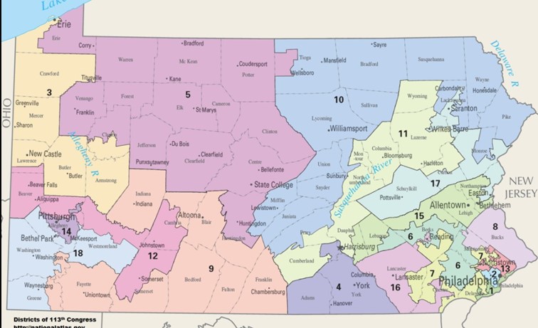
Map above 2011 Version of PA Congressional Districts
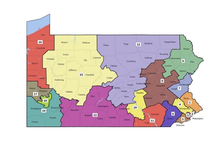
Map above is the new version that is ordered by the PA Supreme Court
When legislatures draw districting maps there is always a temptation to draw the map to the advantage of the party in control of the legislature. Having live in Illinois I am used to some very irregular shaped district maps to make it easier for the party in control to retain districts and get more districts served by members of their political party.
The 2011 version of the map was the issue of a law suit that made it to the PA Supreme Court. The Court ordered the legislature to submit a new map that was free of bias. The legislature did not submit a map by the deadline to the Court released the second map above as their solution.
A new question has been created by the Court’s action. That question is, “Does the Court have the authority to set the boundaries of the districts?” People on both sides of the issue will put forth reasons for their answer to this question. I have no idea which side will prevail. I am thrilled for my Pennsylvania neighbors that it appears they could benefit from the new map if it is finally adopted. More states should look at their maps and see if fairness exists in the way their districts are shaped.